Please add profiles of those who were born, lived or died in Bullitt County, Kentucky.
History
Both France and Britain had traders and colonists who encountered the Shawnee. European colonization of the Americas led to competing claims between those nations to the lands west of the Appalachians and east of the Mississippi River. After suffering defeat by Great Britain in the Seven Years' War (known as the French and Indian War in its North American front), France ceded control in 1763 of its claimed territories.
Nutrient-rich salt licks attracted large herds of bison and other game to the area. Native American tribes made it their hunting grounds, as did the 18th century longhunter. In 1773, after the French and Indian War, the Virginia governor sent Captain Thomas Bullitt (uncle to Alexander Scott Bullitt) into the area to survey for land grants. The most historic of the county's salt licks, Bullitt's Lick, is named after him. As the Revolutionary War led to widespread salt shortages, the Lick became the site of Kentucky's first industry, attracting many settlers to the area.
Colonial veterans of the war were promised land in what was later called Kentucky. Bullitt's Lick became an important saltwork to the region; its salt was harvested and sent by pack train and flatboat as far off as Illinois to the west. The Bullitt's Lick saltwork was Kentucky's first industry and in production until around 1830. By that time, the steamboat and importing of salt brought access to less expensive sources.
The first settlement of the area was also the first station on the Wilderness Road between Harrodsburg and the Falls of the Ohio. It was a fort called Brashear's Station or the Salt River Garrison, built in 1779 at the mouth of Floyd's Fork. Most of the county was settled after the American Revolutionary War. Shepherdsville, named after Adam Shepherd, a prosperous business man who purchased the land near the Falls of Salt River in 1793, is the oldest town and became the county seat.
In December 1796 the county of Bullitt, named after Thomas Bullitt's nephew and Kentucky's first Lieutenant Governor Alexander Scott Bullitt, was organized from land taken from Jefferson and Nelson counties through an act approved on December 13, 1796 by the Kentucky General Assembly. In 1811, the northwestern area of the county expanded to include land given by Jefferson County. In 1824, an eastern area of the county was given to help form Spencer County.
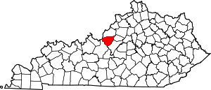
Adjacent Counties
Cities & Communities
Links
National Register of Historic Places