Start My Family Tree Welcome to Geni, home of the world's largest family tree.
Join Geni to explore your genealogy and family history in the World's Largest Family Tree.

Anson County, North Carolina

view all

Profiles

  • Reuben Ard (1769 - 1845)
    GEDCOM Source @R1403462254@ 1840 United States Federal Census Ancestry.com Ancestry.com Operations, Inc. GEDCOM Source Year: 1840; Census Place: Wayne, Kentucky; Roll: 126; Page: 170; Image: 1013; F...
  • James McHenry (1761 - 1842)
    Not the son of John McHenry & Susannah McHenry James McHenry is a DAR Patriot Ancestor, A206641 James McHenry is an NSSAR Patriot Ancestor. NSSAR Ancestor #: P-246426 Rank: Soldier
  • Sarah Ard (1740 - 1778)
    Sarah’s Last name was not McHenry at birth. Unknown maiden name. Biography Widowed when first son John McHenry was less than four years old. Married John Ard and had three more sons and a daughter....
  • Mary A. Harrell (1728 - 1770)
    May be Mary Peacock, but more sources needed. Seen as that in some trees. From . . . 4-- Jacob Harrell [156798] b.ca.1720, Nansemond Co. VA d.Feb_1787, Charleston SC . . . . + Mary ________ [156...
  • Open Source Clip Art
    Jacob Harrell (1750 - 1809)
    . . . . 5-- Jacob Harrell [156808] b.1750, Anson Co. NC . . . . . + Orpha Rabey [156817] wife of Jacob Harrell . . . . . 6-- Rabey Harrell [156818] b.10_Jan_1787, Bertie Co. NC d.25_Jun_1872, Ke...

Please add profiles of those who were born, lived or died in Anson County, North Carolina.

Official Website

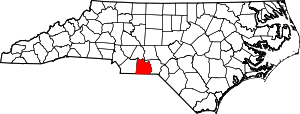
The county was formed in 1750 from Bladen County. It was named for George Anson, Baron Anson, a British admiral, who circumnavigated the globe from 1740 to 1744, and later became First Lord of the Admiralty. Anson purchased land in the state.

Like its parent county Bladen, Anson County was originally a vast territory with indefinite northern and western boundaries. Reductions in its extent began in 1753, when the northern part of it became Rowan County. In 1762 the western part of Anson County became
Mecklenburg County. In 1779 the northern part of what remained of Anson County became Montgomery County, and the part east of the Pee Dee River became Richmond County. Finally, in 1842 the western part of Anson County was combined with the southeastern part of Mecklenburg County to become Union County.

Steven Spielberg filmed The Color Purple mostly in Lilesville, and a large white farmhouse (the Huntley house, which is located in Lilesville, NC and is an old farmhouse located few miles off Highway 74) was used extensively as the main exterior location in that film.

Adjacent Counties

Towns, Townships & Communities

  • Ansonville
  • Burnsville
  • Gulledge
  • Lanesboro
  • Lilesville
  • McFarlan
  • Morven
  • Peachland
  • Pee Dee
  • Polkton
  • Sneedsboro
  • Wadesboro (County Seat)
  • White Store

Cemeteries

Cemeteries of North Carolina

Links

Wikipedia

National Register of Historic Places

NC Gen Web

Genealogy Trails

USGW Archives

Anson Historical Society

North Carolina Estate Files, Anson County Index

Roots Web


upload.wikimedia.org/wikipedia/commons/thumb/a/af/Map_of_North_Carolina_highlighting_Anson_County.svg/300px-Map_of_North_Carolina_highlighting_Anson_County.svg.png