Please add profiles of those who were born, lived or died in Brule County, South Dakota.
History
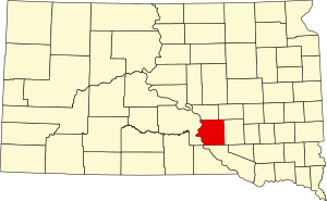
Brule County was created on January 14, 1875, of territory partitioned from Charles Mix County. Its governing structure was also created at that time. However, in May 1875, Brule County was withdrawn from settlement, by order of US President Grant. This order was later annulled, and the organization of Brule County governing structure was completed in September 1879.
On March 9, 1883, the area of Brule County was slightly increased by an addition of former Buffalo County lands. The total area of Brule County was further increased on June 4, 1891, when American Island (in the Missouri River) was attached to the county (from the Sioux Reservation). Its boundaries have remained unchanged since that date.
Adjacent Counties
Cities, Towns, Townships & Communities
Links
National Register of Historic Places
Brule County Free Public Records Directory