Please add profiles of those who were born, lived or died in Cherokee County, Kansas.
History
In 1803, United States acquired from France the 828,000-square mile Louisiana Purchase, the former French lands west of the Mississippi River, for 2.83 cents per acre. This territory included most of the land for modern-day Kansas.
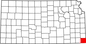
In the 1830s, the United States conducted Indian Removal of the Five Civilized Tribes from the Southeast region, to extinguish their land claims and allow European-American settlement in the area. They were given lands in what was called Indian Territory west of the Mississippi River, mostly in present-day Oklahoma. This part of Kansas was included at the time in the Cherokee Neutral Lands, and the county was named after this tribe.
In 1854, the US organized the Kansas Territory. Settlers began to move into the territory, with violence breaking out between supporters of slavery and those who wanted to abolish it. In 1861, Kansas was admitted as the 34th U.S. state; its constitution prohibited slavery. In 1860, Cherokee County was established.
Baxter Springs, the most populous city in the county, was the original "cow town" in Kansas during the 1870s during the period of cattle drives.
Adjacent Counties
Cities, Townships & Communities
Baxter Springs | Carona | Cherokee | Cokedale | Columbus (County Seat) | Crawford | Crestline | Empire City | Faulkner | Galena | Garden | Hallowell | Keelville | Kniveton | Lawton | Lola | Lowell | Lyon | Melrose | Mineral | Neosho | Neutral | Oswego (part) | Pleasant View | Riverton | Roseland | Ross | Salamanca | Scammon | Shawnee | Sheridan | Sherman | Skidmore | Spring Valley | Stippville | Treece | Turck | Weir | West Mineral
Links
National Register of Historic Places
Cherokee County, Kansas Genealogy Research