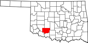


Please add profiles of those who were born, lived or died in Comanche County, Oklahoma.
The county was created in 1901 as part of Oklahoma Territory. It was named for the Comanche tribal nation.
Built on former reservation lands of the Comanche, Kiowa, and Apache in Indian Territory, Comanche County was open for settlement on August 16, 1901 by lottery. The region has three cities and seven towns as well as the Fort Sill military installation and Wichita Mountains Wildlife Refuge. The landscape of the county is typical of the Great Plains with flat topography and gently rolling hills, while the areas in the north are marked by the Wichita Mountains. Interstate 44 and three major US Highways serve the county by ground, while the Lawton-Fort Sill Regional Airport serves the county by air.
Comanche County's economy is largely based in the government sector which consist of half of the county's Gross Domestic Product. The governance of the county is led by a three commission board, which are elected in four year staggered terms. The county is served by several school districts and Cameron University in education as well as three hospitals for health care.
Adjacent Counties
Communities
Links
National Register of Historic Places
