Please add profiles of those who were born, lived or died in Essex County, Vermont.
History
Prior to the arrival of colonists of European descent, the area was populated by the Abenakis. They used the Connecticut and Nulhegan rivers as primary means of travel through the area along with many subsidiary rivers and streams. The culture was mostly hunter-gatherer with a combination of agriculture, hunting and fishing. While the rivers provided good fishing the primary food animal was moose.
Vermont was divided into two counties in March 1778. In 1781 the legislature divided the northernmost county, Cumberland, into three counties: Windham and Windsor, in approximately the modern location for those counties. The northern remainder was called Orange County. This latter tract nearly corresponded with the old New York county of Gloucester, organized by that province March 16, 1770, with Newbury as the shire town.
On September 3, 1783, as a result of the signing of the Treaty of Paris, the Revolutionary War ended with Great Britain recognizing the independence of the United States. Vermont's border with Quebec was established at 45 degrees north latitude.
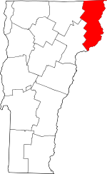
On November 5, 1792, the legislature divided Chittenden and Orange counties into six separate counties, as follows: Chittenden, Orange, Franklin, Caledonia, Essex, and Orleans. No reason is given for the county being named after the county of Essex in England.
Adjacent Counties & Provinces
Towns
Links
Silvio O. Conte National Fish & Wildlife Refuge (part)