Please add profiles of those who were born, lived or died in Holmes County, Mississippi.
The county is named in honor of David Holmes, territorial governor and the first governor of the state of Mississippi and later United States Senator for Mississippi.
The western border of the county is formed by the Yazoo River; it is next to the Mississippi Delta, and shares its characteristics. The eastern border is formed by the Big Black River and the eastern part has hills. The county was developed for cotton plantations in the antebellum era before the American Civil War, with most properties of the period located along the riverfronts for transportation access.
By the turn of the 20th century, a majority of the landowners in the Delta counties were black. Effectively blacks were disenfranchised by the new constitution of 1890; the loss of political power added to their economic problems associated with the financial Panic of 1893. Unable to gain credit, many of the first generations of African-American landowners lost their properties by 1920. In this period, they were also competing for land with the better-funded timber and railroad companies. Afterward, the blacks were forced to become sharecroppers or tenant farmers to make a living.
During the period after Reconstruction and through the early 20th century, Holmes County had 10 documented lynchings in the period from 1877 to 1950, most around the turn of the 20th century.
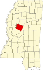
Adjacent Counties
Cities & Towns
Other Communities: Acona, Coxburg, Ebenezer, Egypt, Eulogy, Franklin, Good Hope, Howard, Ituma, Marcella, Montgomery, Oregon, Owens Wells, Pluto, Richland, Thornton and Tolarville
Links
MS Genealogy & History Network
National Register of Historic Places
Hillside National Wildlife Refuge (part)
Mathews Brake National Wildlife Refuge (part)
Morgan Brake National Wildlife Refuge
Theodore Roosevelt National Wildlife Refuge (part)
"USS Holmes County" - LST 836