Please add profiles for those who were born, lived or died in Indiana County, Pennsylvania.
History
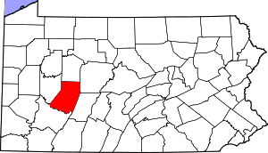
Indiana County (Indiana meaning "land of the Indians") derives its name from the so-called "Indiana Grant of 1768" that the Iroquois Six Nations were forced to make to "suffering traders" under the Fort Stanwix Treaty of 1768. The Iroquois had controlled much of the Ohio River valley as their hunting grounds since the 17th century, and Anglo-American colonists were moving into the area and wanted to develop it. Traders arranged to force the Iroquois to grant land under the treaty in relations to losses due to Pontiac's Rebellion.
Some of the grantees joined forces with the Ohio Company, forming a larger development company based on enlarging their grant of land. They proposed that the entire large area would become a new British colony, possibly to be called Pittsylvania or Vandalia. It was to be bordered on the north and west by the Ohio River, and made up of what are now parts of eastern Kentucky, northern West Virginia (then part of the Virginia Colony), and western Pennsylvania. Anglo-European colonists from Virginia and Pennsylvania had already started to move into the area, which was identified by these various names as Indiana and the other above names on some maps of the late 1700s.
Opposition from other interest groups and the American Revolutionary War intervened before Britain approved such a colony. Afterward, some United States speculators proposed setting up a state in this area to be called Vandalia, or Westsylvania, as appears on some maps of the period.
But both the states of Virginia and Pennsylvania claimed the land based on their colonial charters. In establishing the Mason–Dixon line, the federal government assigned the Indiana Grant to Pennsylvania. As population increased after the war, this county was made up in 1803 of territory from Westmoreland and Clearfield counties; it was formally organized in 1806.
Kentucky and West Virginia continued to be associated with Virginia for some time, being separately admitted as states in the early 19th century and during the American Civil War, respectively. The area in Pennsylvania was unrelated to and was physically separated from the later named Indiana Territory established north of the Ohio River in 1800 by the new United States; that territory was eventually admitted to the Union as the State of Indiana.
The county proclaims itself the "Christmas Tree Capital of the World", shipping over one million trees annually.
Adjacent Counties
Boroughs
Other Townships & Communities: Alverda, Arcadia, Armstrong, Banks, Black Lick, Brush Valley, Buffington, Burrell, Canoe, Center, Cherryhill, Chevy Chase Heights, Cherryhill, Clarksburg, Commodore, Conemaugh, Coral, Covode, Dicksonville, Dilltown, East Mahoning, East Wheatfield, Gipsy, Graceton, Grant, Green, Heilwood, Home, Iselin, Jacksonville, Jewtown, Locust, Loop, Lucerne Mines, Mentcle, Montgomery, Nolo, North Mahoning, Pine, Rayne, Rexis, Robinson, Rochester Mills, Rossiter, South Mahoning, Starford, Strongstown, Washington, Wehrum, West Lebanon, West Mahoning, West Wheatfield, White and Young
Links
Indiana County History & Heritage
National Register of Historic Places