Please add profiles of those who were born, lived or died in Jeff Davis County, Texas.
History
Indian pictographs in the Painted Comanche Camp of Limpia Canyon were discovered by the Whiting and Smith Expedition of 1849.
In March 1849, Lieutenants William H. C. Whiting and William F. Smith were sent out by Maj. Gen. William J. Worth of the Texas 8th Military Department to look for a route from San Antonio to El Paso del Norte. A second party, led by Dr. John S. Ford and financed by a group of Austin merchants, pioneered a trail that ran north of the Davis Mountains before turning southward toward El Paso. In June 1849 Lt. Col. Joseph E. Johnston, attached to Bvt. Maj. Jefferson Van Horne's battalion, was sent for additional surveying.
At El Paso, Horne established Fort Bliss. Texas Ranger Big Foot Wallace escorted the San Antonio-El Paso Mail coach through the mountains. Fort Davis was established in 1854. The land was leased from surveyor John James at $300 a year. The federal government surrendered the fort to the Confederacy in 1861. The CSA abandoned it in 1862 after their defeat at Glorieta Pass, New Mexico. The facility was reoccupied by U.S. troops on July 1, 1867, as a base for actions against Native American forces.
As white migrants moved into the area, tensions with Native Americans increased. The groups competed for resources, and armed conflicts were conducted for more than two decades, especially after the Civil War. In August 1861, Mescalero Apache under Chief Nicolas attacked Fort Davis, driving off livestock and killing three people. In the ensuing chase by the cavalry, Nicolas ambushed the soldiers, killing them all.
In September 1868 at Horsehead Hills, a group of volunteer Mexican and buffalo soldiers from Fort Davis attacked and destroyed a Mescalero village to recover captives and stolen livestock. In January 1870, a group of soldiers attacked a Mescalero Apache village near Delaware Creek in the Guadalupe Mountains. In July 1880, soldiers at Tinaja de las Palmas attacked a group of Mescaleros led by Chief Victorio. In August 1880, buffalo soldiers ambushed Victorio at Rattlesnake Springs. Victorio retreated to Mexico, where he was killed in October of that year by Mexican soldiers. The last Indian depredation in the area was at Barry Scobee Mountain in 1881.
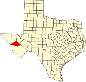
The Texas Legislature established Jeff Davis County on March 15, 1887. Cattle ranchers began operating in the county in the 1880s. The towns of Valentine and Chispa became supply centers for the ranchers and were later designated as railroad stops as railway construction entered the area.
Adjacent Counties
Towns & Communities
Links
Fort Davis National Historic Site
National Register of Historic Places